Mexico Cancun 2004
Some of the images are taken from internet.
http://cbdpresents.blogspot.com/2013/07/10-best-places-and-tours-to-experience.html
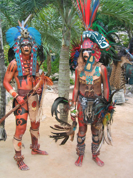
Mayan Culture:
http://alternativearchaeology.jigsy.com/mayan-society
El Becem
http://juditjardinera.wordpress.com/tag/yucatan/
Mayan Civilization:
http://ptc2506.com/featured_sites/mayan_civilization/photos.html
XCaret:
http://www.theguardian.com/travel/2009/oct/31/mexico-mayan-riviera-theme-park
Archaeology museum Cancun opened 2012
http://archaeology-travel.com/news/new-archaeology-museum-cancun/
List of Mayan cities:
http://en.wikipedia.org/wiki/List_of_Maya_sites#mediaviewer/File:Tikal_Guatemala_Templo_I_2008.jpg
- Many years ago I have developed interest towards the culture in Central and Latin America and especially Mexico.The culture of the Mayans has being a big interest of mine.They have developed a civilization on the of the countries Guatemala, Mexico, Belize and El Salvador.There are around 30 cities in Mexico only discovered and restated there with their palaces houses and observatories.The magor one are:Belankanche,Becan,Bellote,Bolonchen,Bolonpak,Calakmul,Campache,Cansacbe,Conotilo,Chacchoben,Chactun,Chacalal,Chichmul,Coba,Uxmal,Cominat,Cozumel,Culuba and Balamk.Ancient Maya art refers to the material arts of the Maya civilization, an eastern and south-eastern Mesoamerican culture that took shape in the course of the later Preclassic period (500 BC to 200 AD), saw its greatest flowering during the seven centuries of the Classic period (c. 200 to 900 AD), and went through an extended Postclassic phase before the upheavals of the sixteenth century destroyed courtly culture and put an end to the Mayan artistic tradition. Many regional styles existed, not always coinciding with the changing boundaries of Maya polities. Olmecs, Teotihuacanand Toltecs have all influenced Maya art. Traditional art forms have mainly survived in weaving and the design of peasant houses.The lay-out of the Maya towns and cities, and more particularly of the ceremonial centers where the royal families and courtiers resided, is characterized by the rhythm of immense horizontal stucco floors of plazas often located at various levels, connected by broad and often steep stairs, and surmounted by temple pyramids.Outside the ceremonial center (especially in the southern area sometimes resembling an acropolis) were the structures of lesser nobles, smaller temples, and individual shrines, surrounded by the wards of the commoners. Dam-like causeways (sacbeob) spread from the 'ceremonial centers' to other nuclei of habitation. Under successive reigns, the main buildings were enlarged by adding new layers of fill and stucco coating. Fitting in with the concept of a 'theatre state', more attention appears to have been given to aesthetics than to utilitarian functionality and solidity of construction. Careful attention, however, was placed on directional orientation.Among the various types of structures should be mentioned:
- Ceremonial platforms (usually less than 4 meters in height).
- Courtyards and palaces.
- Other residential buildings, such as a writers' house and a possible council house in Copan.
- Pyramids, often containing burials in their base or fill, with sanctuaries on top. The outstanding example are the many clustered dynastic burial temples of Tikal's North Acropolis. The chief Post-Classic temple pyramids of Chichen Itzáand Mayapán evince a radial four-staircase structure.
- Ball courts.
- 'Triadic pyramids' consisting of a dominant structure flanked by two smaller inward-facing buildings, all mounted upon a single basal platform;
- 'E-groups' consisting of a square platform with a low four-stepped pyramid on the west side and an elongated structure, or, alternatively, three small structures, on the eastern side;
- 'Twin pyramid complexes', with identical four-stepped pyramids on the east and west sides of a small plaza; a building with nine doorways on the south side; and a small enclosure on the north side housing a sculpted stela with its altar and commemorating the king's performance of a k'atun-ending ceremony.
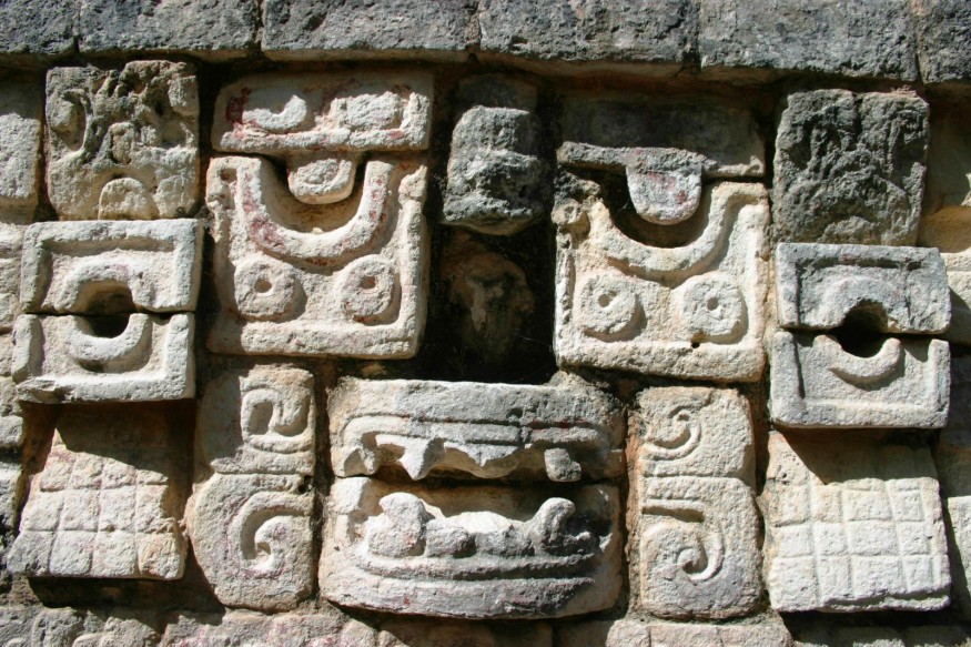
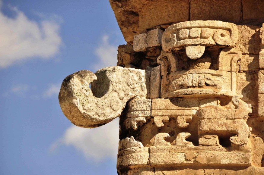
The Classic Puuc, Chenes, and Rio Bec architecture of Yucatán is characterised by the geometrical reduction of realistic decoration, the stacking of rain god snouts to build facades, and the use of portals shaped like serpent mouths; the Rio Bec style includes the use of solid pseudo temple-pyramids.The main Preclassic sculptural style from the Maya area is that of Izapa, a large settlement on the Pacific coast where many stelas and (frog-shaped) altars were found showing motifs also present in Olmec art. The stelas, usually without inscriptions, often show mythological and narrative subjects, some of which appear to relate to the Twin myth of the Popol Vuh. Nonetheless, it remains uncertain if the inhabitants of Izapa were ethnically Mayan. For the Classic Period of the Mayas, the following major classes of stone sculpture may be distinguished.
- Stelas. These are large, elongated stone slabs usually covered with carvings and inscriptions, and often accompanied by round altars. Typical of the Classical period, most of them depict the rulers of the cities they were located in, often disguised as gods. Although the rulers' faces, particularly during the later Classic Period, are naturalistic in style, they usually do not show individual traits; but there are notable exceptions to this rule (e.g., Piedras Negras, stela 35). The most famous stelas are from Copan and nearby Quirigua. They are outstanding for their intricateness of detail, those of Quirigua also for sheer height. Both the Copan and Tonina stelas approach sculptures in the round. From Palenque, otherwise a true Maya capital of the arts, no significant stelae have been preserved.
- Lintels spanning doorways, and panels and tablets set in the walls and piers of buildings and the sides of platforms. Particularly Palenque and Yaxchilan are renowned for this kind of art works - Yaxchilan chiefly for its long series of lintels in deep relief, some of the most famous of which show meetings with ancestors, Palenque for the large tablets adorning the inner sanctuaries of the Cross Group temples, and for refined masterworks such as the Palace Tablet, the 'Tablet of the Slaves', and the multi-figure panels of the temple XIX and XXI platforms.[16] King Pakal's carved sarcophagus lid - without equal in other Maya kingdoms - might also be included here.
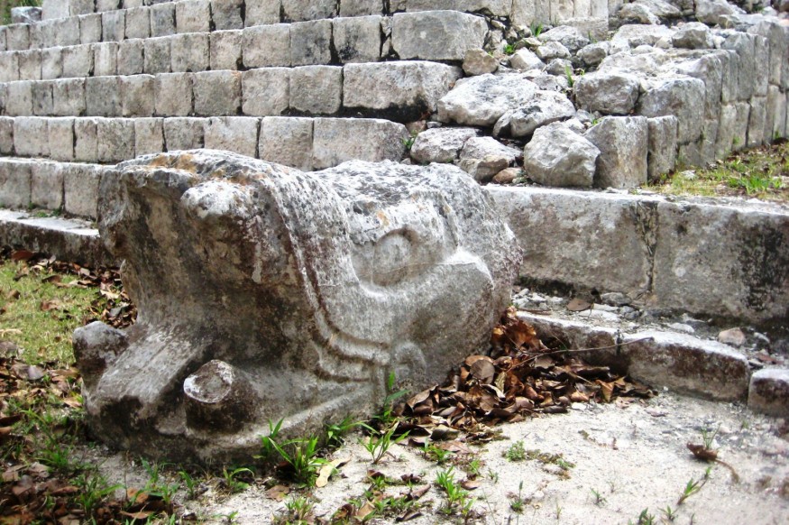
- Altars, rounded or rectangular, sometimes resting on three or four boulder-like legs. They may be wholly or partly figurative (e.g., Copan turtle altar) or have a relief image on top, sometimes consisting of a single Ahau day sign (Caracol, Tonina).
- Ball court markers, or rounded relief carvings placed in the central axis of the floors of ball courts (such as those of Copan, Chinkultic, Tonina), and usually showing royal ball game scenes.
- Monumental stairs, most famously the giant Hieroglyphic Stairway of Copan. The hewn stone blocks of hieroglyphic stairways together constitute an extensive text. Stairways can also be decorated with a great variety of scenes, particularly the ball game (La Corona). Sometimes, the ball game becomes the stairs' chief theme (Yaxchilan), with a captive depicted inside the ball, or, elsewhere (Tonina), a full-figure captive stretched out along the step.
- Thrones, with a broad, square seat, and a back sometimes iconically shaped like the wall of a cave, and worked open to show human figures. Examples from Palenque and Copan have supports showing cosmologic carriers (Bacabs, Chaaks).
- Stone sculpture in the round, represented by statuary, such as the seated Copan scribe, by certain figurative architectural elements, and by giant sculptures, such as the symmetrically-positioned jaguars and simian musicians of Copán, that were integral parts of architectural design. The so-called 'zoomorphs' (large boulders sculpted to resemble living creatures), especially known from the petty kingdom of Quirigua, may have functioned as altars.
Mayans did not know anything about iron tools or building with animal power but still has developed grand civilisation.
I have read several authors and I was inspired by them to visit the continent.During my study at university I had exam on Mayan architecture and stone reliefs.The Mayan alphabet still hasnt being read but their stone work its impressive and looks like a lace.
Thinking of visiting Mexico for many years finally I had this lovely opportunity with my husband then.We had some days off and we packed ourselves to this lovely place Cancun.
With Keith we have visited Mexico for 10 days as we had really busy trip.We had to visit lots of places and we staid on small hotel more of it like hacienda in downtown Cancun.Cancun its situated in a Yucatan Peninsula.
This all part of Mexico its full of archaeological sites and also worth to get in there just for a scuba diving or snorkeling into Caribbean sea.We did not have allot of information about the roots and distances between this very important places so we had to do it by asking so many people where and how to get to places.
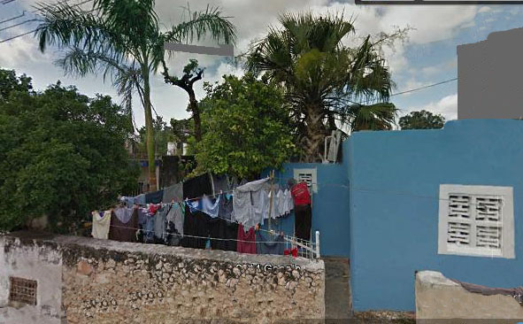
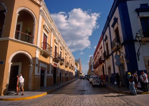
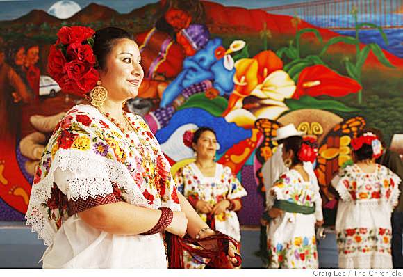
The flight was excellent and we had a bit of a turbulence but has passed quite nicely.On internet we have found a nice hotel at downtown Cancun with fantastic rooms and heavy wooden furniture and TV and air conditioning.At the back yard we had so many plants and also some birds.Downtown Cancun oits quite bizarre to walk trough.Has a very small houses painted in a different colors and also a little gardens.You can see some gratifies on the walls.We was situated near the market place where you could find so many things such as hand made shirts from hand painted linen and also clay masks and rugs.There was also several small artisan shops sealing jewelries and some ceramic pots.At the center of downtown Cancun you could listen almost every evening some life music performed by local Mexicans.The name Cancún, Cancum or Cankun first appears on 18th century The meaning of Cancún is unknown, and it is also unknown whether the name is of Maya origin. If it is of Maya origin, possible translations include "Place/Seat/Throne of the Snake" or "Enchanted Snake". Snake iconography was prevalent at the pre-Columbian site of Nizuc.[When development was started on January 23, 1970, Isla Cancún had only three residents, caretakers of the coconut plantation of Don José de Jesús Lima Gutiérrez, who lived on Isla Mujeres, and there were only 117 people living in nearby Puerto Juarez, a fishing village and military base.
"Due to the reluctance of investors to bet on an unknown area, the Mexican government had to finance the first nine hotels." The first hotelfinanced was the Hyatt Cancún Caribe, but the first hotel actually built was the Playa Blanca, which later became a Blue Bay hotel, and is now Temptation Resort. At the time it was an elite destination, famous for its virgin white sand beaches.In the 21st century, Cancún had largely avoidedbloodshed associated with the trade of illegal drugs and reportedly known for retail drug sales to tourists and as a center of money laundering.The links with Cancún date from the 1990s and early 2000s, when the area was controlled by theJuárez and Gulf drug cartels. In recent years Los Zetas, a group that broke away from the Gulf Cartel, has taken control of many smuggling routes through the Yucatán, according to the U.S.Drug Enforcement Administration.Apart from the island tourist zone (actually part of the world's second-longestcoralreef), the Mexican residential section of the city, the downtown part of which is known as "El Centro," follows a master plan that consists of "supermanzanas"(superblocks), giant trapezoids with a central, open, non-residential area cut in by u-shaped residential streets. These open centers usually have walkways and 'sidewalks' around a central garden park, or soccer fields, or a library, etc. which make the mainland "Mexican" Cancún bicycle-friendly.[citation needed] The residential roads of central or 'Mainland' Cancún, U-shaped and culs-de-sacs, insulate housing from the noise and congestion of the main flow of traffic.[citation needed]Mainland Cancún has a central market that resembles an outlet mall, colorful buildings on a pedestrian city block.[citation needed]Ave. Tulum is the main north-south artery, connecting downtown to the airport, which is some 30 km (19 mi) south of downtown. Tulum is bisected by Ave. Cobá. East of Ave. Tulum, Cobá becomes Ave. Kukulcan which serves as the primary road through the 7-shaped hotel zone. Ave. Tulum ends on the north side at Ave. Paseo José López Portillo which connects to the main highway west to Chichén Itzá and Mérida. Another major north-south road is Ave. Bonampak which runs roughly parallel to Ave. Tulum. The main ferry to Isla Mujeres is located in Puerto Juarez, on Ave. Paseo José López Portillo.
To save on the cost of installing sewer systems and other public services, the design of much of the rest of the city reverted to the grid plan after Hurricane Gilbert in 1988. The newest upper-middle-class residential areas reflect the original plan, but are much less intimate. Less expensive developments are composed almost entirely of identical one- or two-story small row-houses, sometimes built around interior plazas or 4 story apartment blocks. Until recently, most mainland buildings were four stories or shorter; since 2005, there has been an influx of condominium and luxury retail and office space concentrated along Ave. Bonampak.
Cancún's Mainland or Downtown area has diverged from the original plan; development is scattered around the city. The remaining undeveloped beach and lagoon front areas outside the hotel zone are now under varying stages of development, in Punta Sam and Puerto Juarez to the north, continuing along Bonampak and south toward the airport along Boulevard Donaldo Colosio. One development abutting the hotel zone is Puerto Cancún, also Malecon Cancún is another large development.
Mayan archaeological zones
El Rey archaeological zone
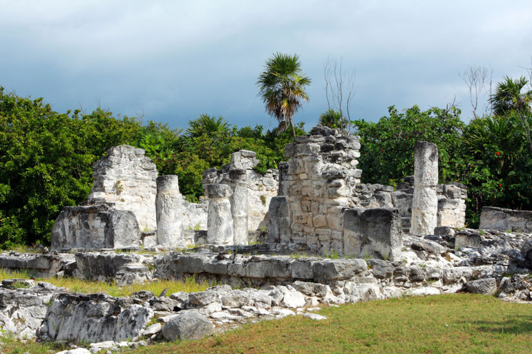
There are some small Mayan vestiges of the pre-Columbian Maya civilization in Cancún. El Rey (Las Ruinas del Rey) is located in the Hotel Zone. El Meco, a more substantial site, is found on the mainland just outside the city limits on the road north to Punta Sam.
Close by in the Riviera Maya and the Grand Costa Maya, there are sites such as Cobá andMuyil (Riviera) the small Polé (now Xcaret), andKohunlich, Kinichná, Dzibanché, Oxtankah,Tulum, and Chacchoben, in the south of the state. Chichén Itzá is in the neighboring state of Yucatán
On a first day we have walked around the town and in the aria of the big hotels.They are very American as they look.In one of the hotels we have found a Gide and asked for a trip to the Mayan city of Chicen Itza.Cancún (Spanish pronunciation: is a city in southeastern Mexico, located on the northeast coast of the Yucatán Peninsula in the Mexican state of Quintana Roo. It is a major world-renowned tourist destination, as well as being the seat of the municipality of Benito Juárez. The city is located on the Caribbean Sea, and is one of the easternmost points in Mexico. Cancún is located just north of Mexico's Caribbean coast resort band known as the Riviera Maya.
Yucatan Peninsula has the most distinctive vegetation in Mexico and around the world.
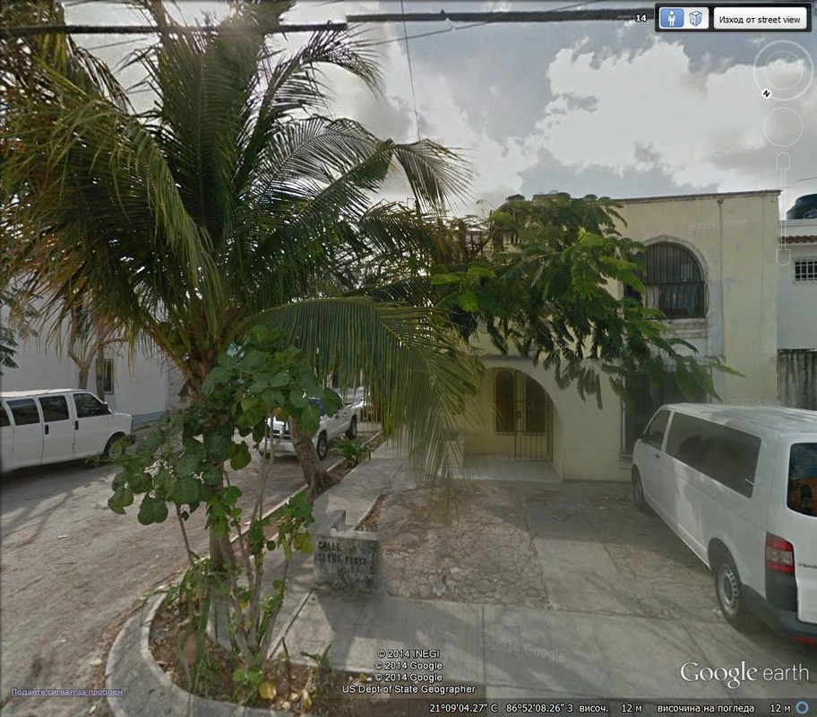
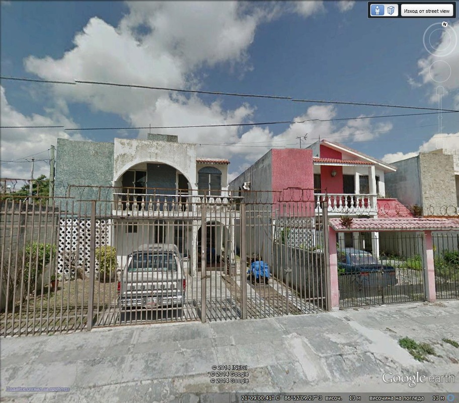
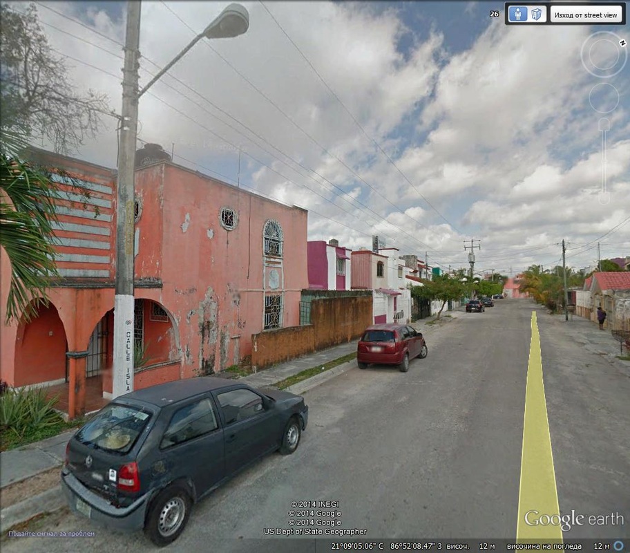
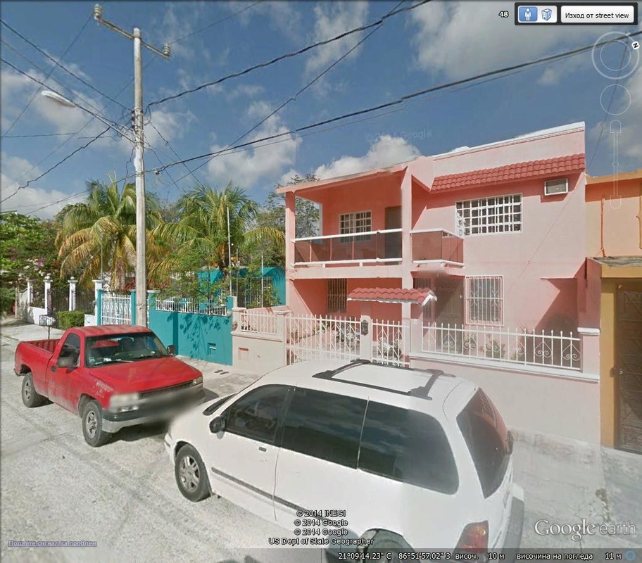
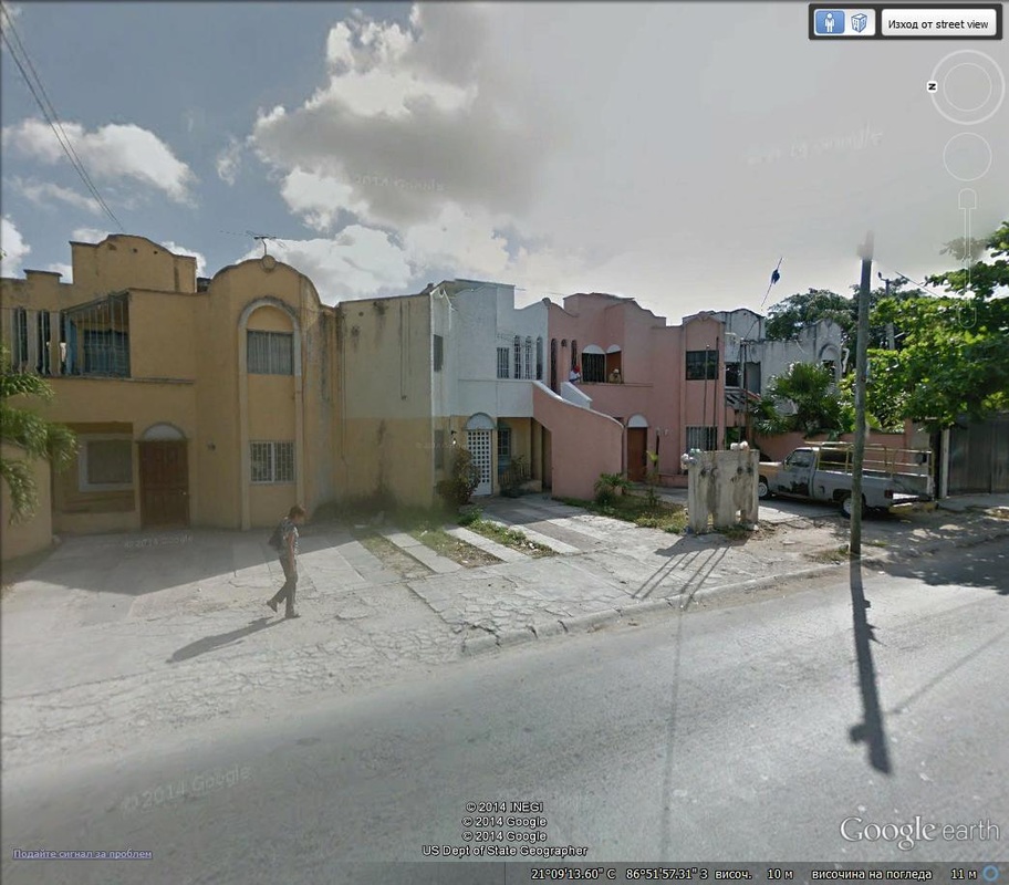
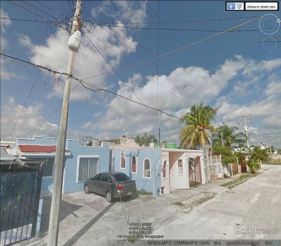
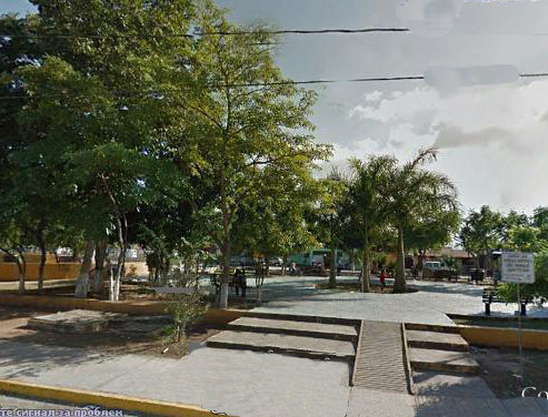
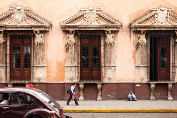
Downtown Cancun:
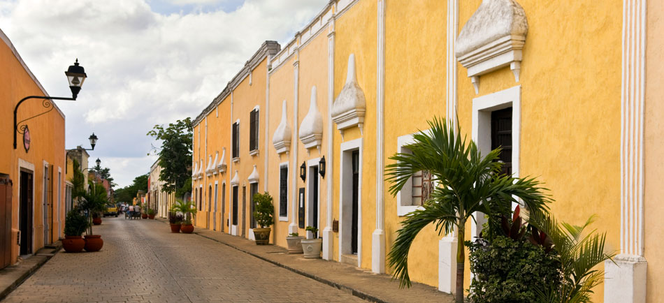
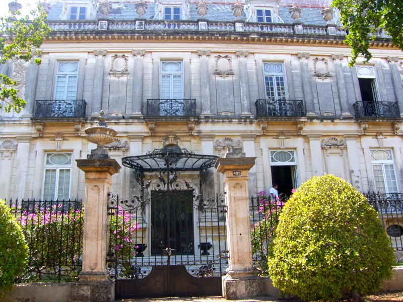
To emphasis even more over the Mexican architecture I have to say thatits one of the most unique in Latin America.Has sharp corners and also irregular shapes.Sometimes the fences of the houses are glued to the house itself.Most of them have flat roofs and balcony tin ellipse frames. frames.They are not logical shapes and some of the houses do not have any windows.In the poor arias there is no gardens.Most of the buildings are painted in very bright colors and iron frames on the windows.One part of the houses has extended large balconies .The taller house its on two floors.

|

|
Yucatan Peninsula has the most distinctive vegetation in Mexico and around the world.
More of the interesting plants living in Yucatan Peninsula,such as chenille plant,Agave,hibiscus,maranga Molada
Langua de Vaca,The cabbege palmeto Palm,Vaitchia palm,Guano Palm,Areca Palm,Pecarry wood and many more such as: Horticucle Preso,Orhidea Riviera maya,Ramon tree and Brosimum alicastrum,African tullep.
|
|

|

|

|


|

|

|

|


The history of the northern region of the Yucatan Peninsula is a fascinating tale of both Mayan and Hispanic peoples. Cancun is recognized as the gateway to the Mundo Maya, an enormous geographic region that includes five Mexican states (Yucatan, Quintana Roo, Campeche, Tabasco, and Chiapas), and five countries (Mexico, Belize, Guatemala, Honduras, and El Salvador).
Historical evidence indicates the presence of a Mayan culture at least as far back as 1800 B.C., with the Mayans rising in prominence between 200 B.C. and A.D. 1000. The ancient Maya referred to themselves as the children of the Mayab or inhabitants of the Land of the Chosen. Their settlements were extensive in the Yucatan Peninsula and stretched southward into Central America. Part of the excitement of a visit to Cancun is its accessibility to a world gone by. Remains of the ancient Mayan civilization are scattered throughout the Yucatan Peninsula. Some, like the archaeological site called “El rey”, at the Sheraton Cancun Resort and Towers, are right in Cancun.
“El Rey” is located walking distance from the Hilton Club (Blvd. Kukulcan Km. 19). El Rey, known to some as the playground of the ancient Mayans, had its peak during the Post classic period (A.D. 1250-1630). The site includes plazas outlined by buildings and platforms that are connected by a 220 yard path. It is named after a skeleton that was found on the site, thought to be that of a king (El Rey is Spanish for “the king”). El Rey is open to tourists from 8 a.m. to 5 p.m. Entrance fee is $50. Pesos. Next to the Sheraton, Cancun Resort and Towers, in the highest point in mostly flat Cancun, lies Yamil Lu’um. The site consists of two small temples that were likely used as watchtowers and lighthouses between 500 and 700 years ago.


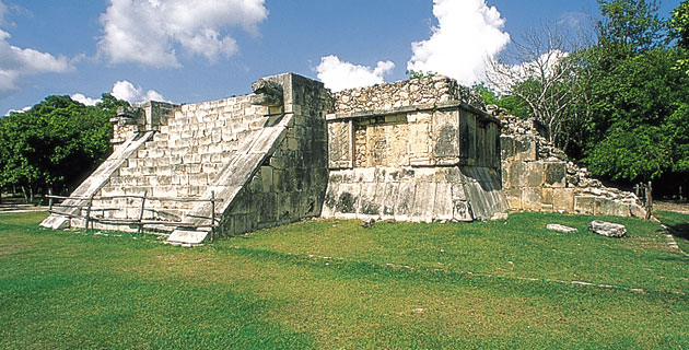
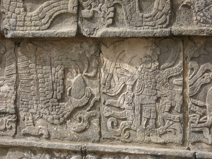
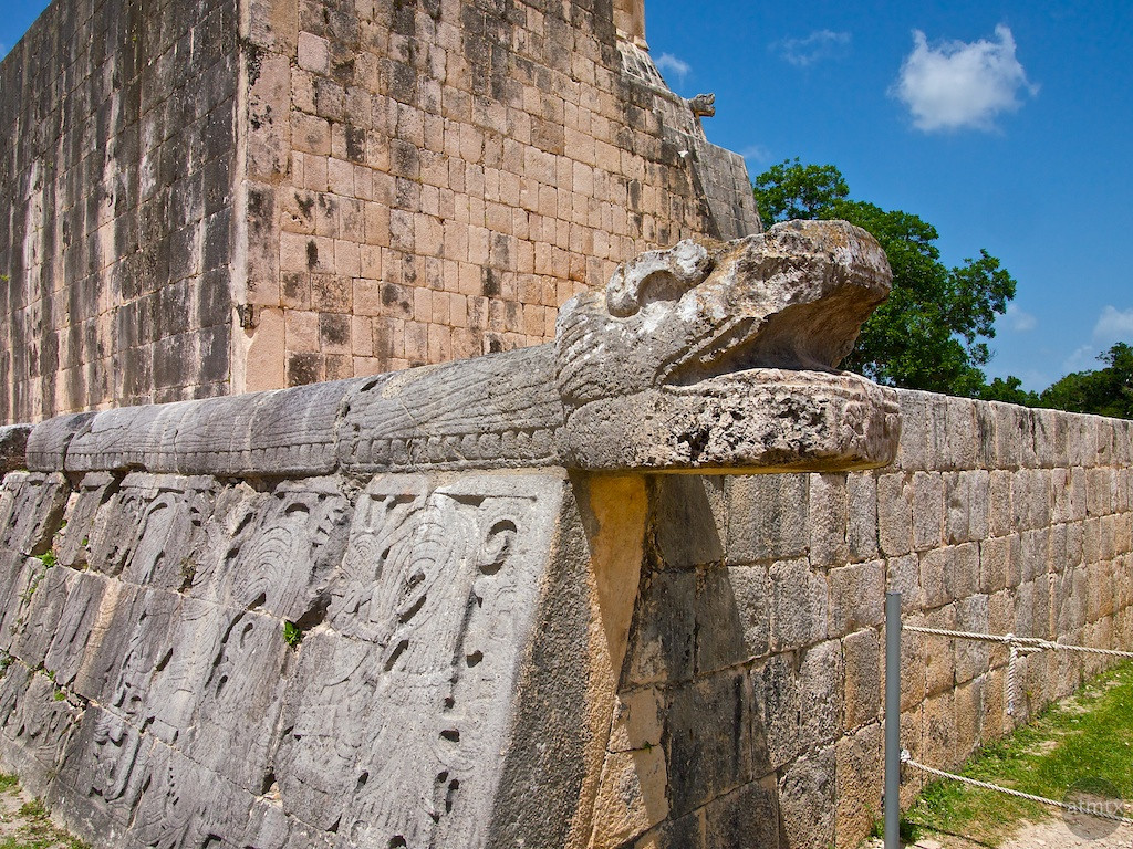
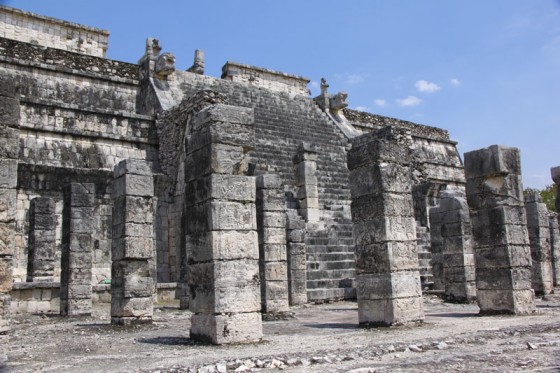
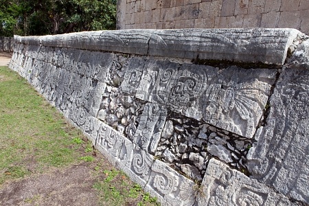
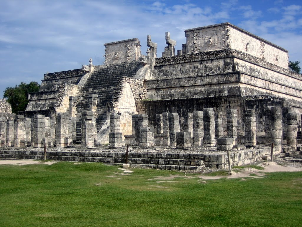
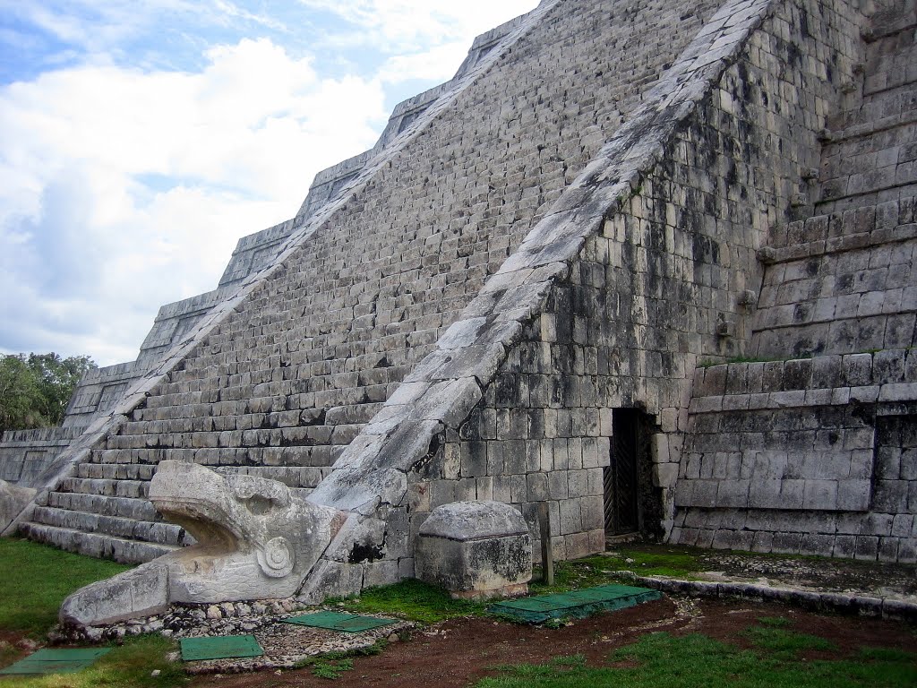
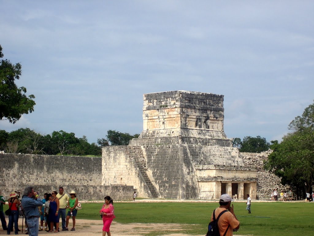
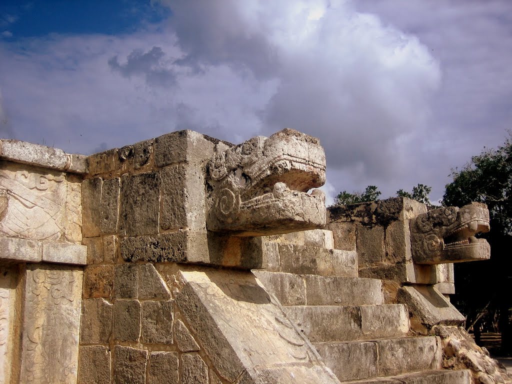
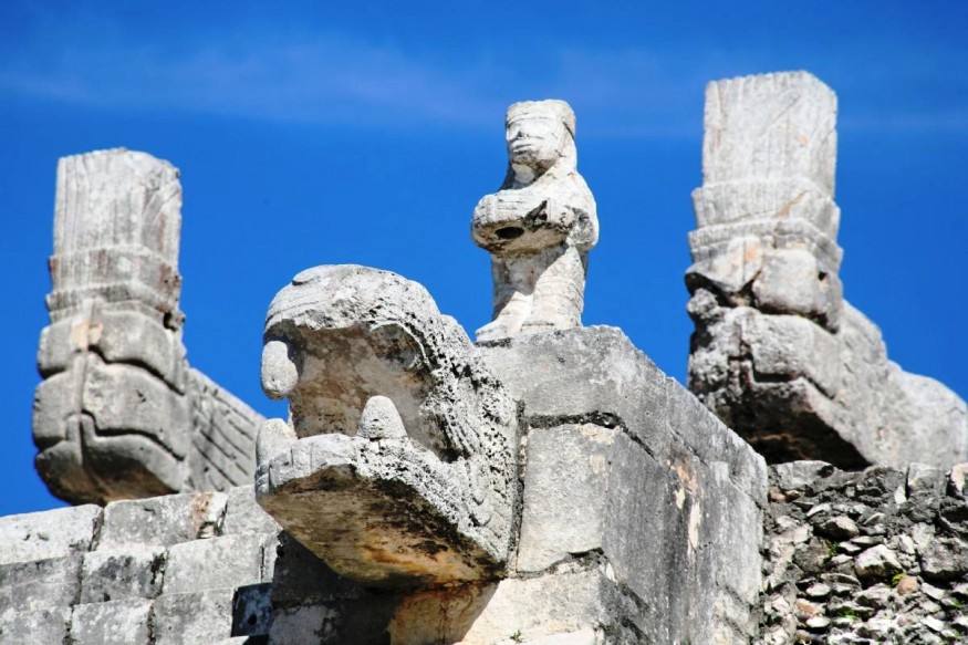
Chichen Itza is a large complex dating from Pre columbian age.
|
Its one of the seven wonders of the world
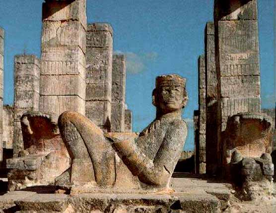
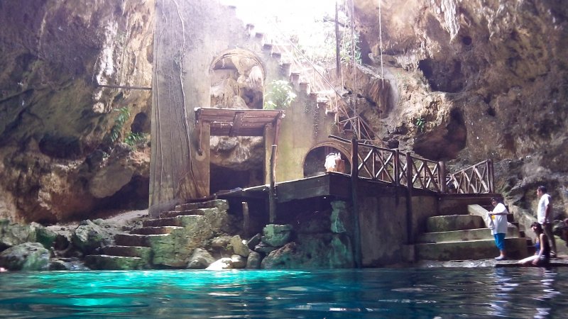
The complex its situated in a municipality of Tinum. he layout of Chichen Itza site core developed during its earlier phase of occupation, between 750 and 900 AD. Its final layout was developed after 900 AD, and the 10th century saw the rise of the city as a regional capital controlling the area from central Yucatán to the north coast, with its power extending down the east and west coasts of the peninsula. The earliest date discovered at Chichen Itza is equivalent to 832 AD, while the last known date was recorded in the Osario temple in 998. Chichen Itza was a major focal point in the northern Maya lowlands from the Late Classic (c. AD 600–900) through theTerminal Classic (c.AD 800–900) and into the early portion of the Early Postclassicperiod (c. AD 900–1200). The site exhibits a multitude of architectural styles, reminiscent of styles seen in central Mexico and of the Puuc and Chenes styles of the northern Maya lowlands. The presence of central Mexican styles was once thought to have been representative of direct migration or even conquest from central Mexico, but most contemporary interpretations view the presence of these non-Maya styles more as the result of cultural diffusion. Has a large observatory called Caracol Kukulkan pirtamide and temple of women. Another major and magnificent structure, at Chichén-Itzá, is the Pyramid El Castillo , which is the site of the Equinox solar phenomena. The solar phenomena itself is a shadow that appears during the equinoxes in which a serpent is depicted climbing up the pyramid’s steps in March and down them in September. El Castillo is 78 feet tall and literally means "castle" in Spanish. It is the pyramid which is most notably accredited to not only the equinox phenomena but dedicated to the god Kukulcan, or more familiarly, Quetzacoatl. It also has cenot called sagrado 
|

|

|

|

|

|
|
|
|
|
|

|
|

|

|


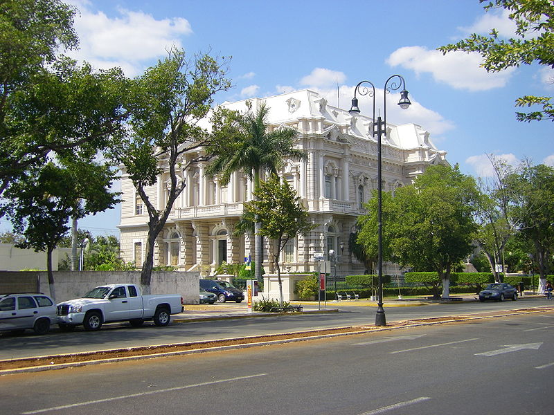
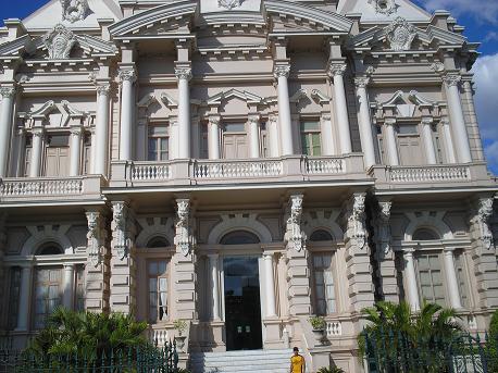
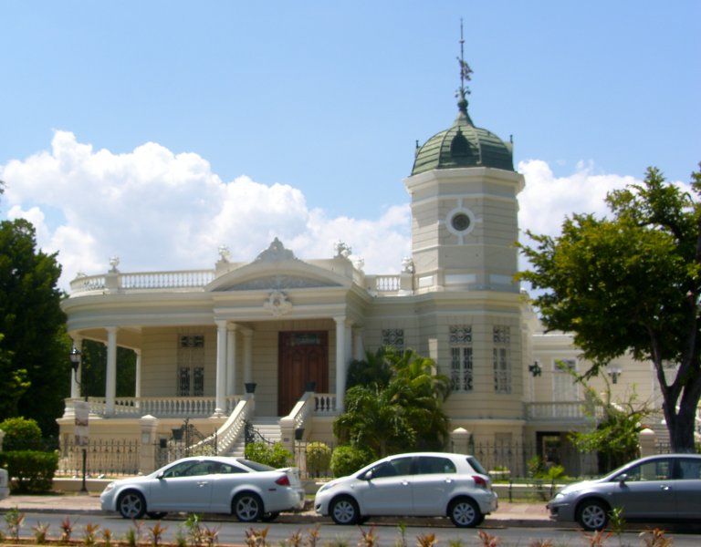
Town Merida
is the capital of the Mexican state of Yucatán and largest city of the Yucatán Peninsula. It is located in the northwest part of the state, about 35 kilometres (22 miles) from the Gulf of Mexico coast. The city is also the municipal seat of the Municipality of Mérida, which includes the city and the areas around it.
According to the 2010 census, the population of Mérida was 970,377, ranking 12th among the most populous Mexican metropolitan areas. The municipality's area is 858.41 km2 (331.43 sq mi). The metropolitan area includes the municipalities of Mérida, Umán and Kanasín and had a population of 1,035,238 in the same 2010 census. It is the largest of the four cities of the world that share the name Mérida, the other three being in Spain, Venezuela, and the Philippines.
The city, like much of the state, has heavy Mayan, French, British, and to a lesser extent Dutch influences. Mérida has the highest percentage of indigenous persons of any large city in Mexico with approximately 60% of all inhabitants being of the Maya ethnicity.
Mérida is serviced by Manuel Crescencio Rejón International Airport

|

|
|
|

|


|
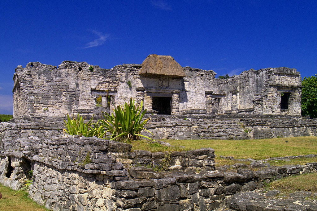
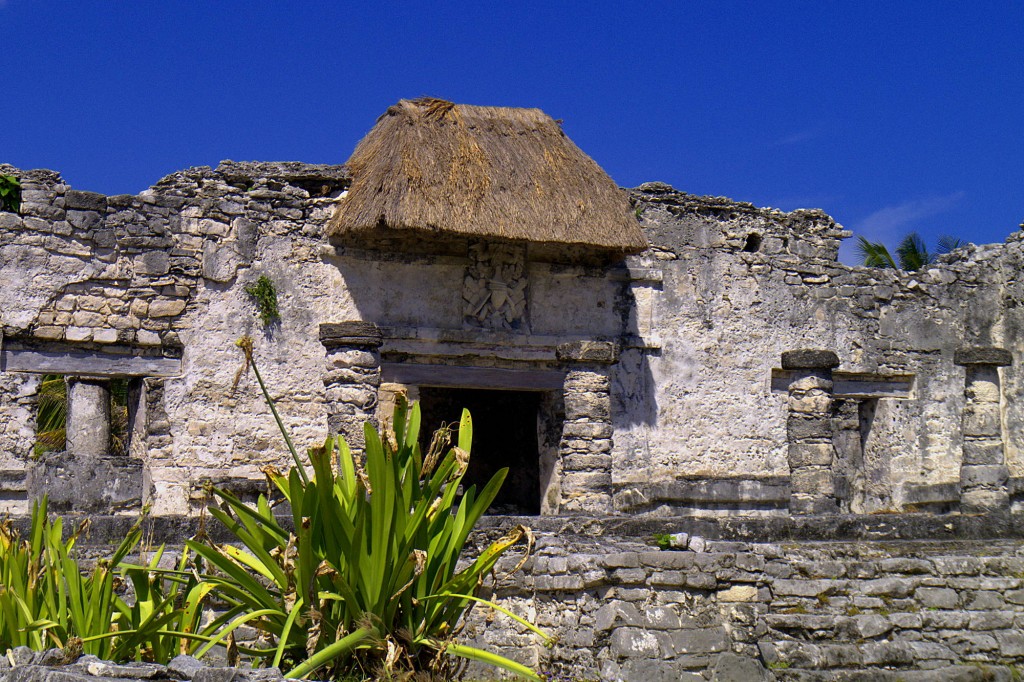
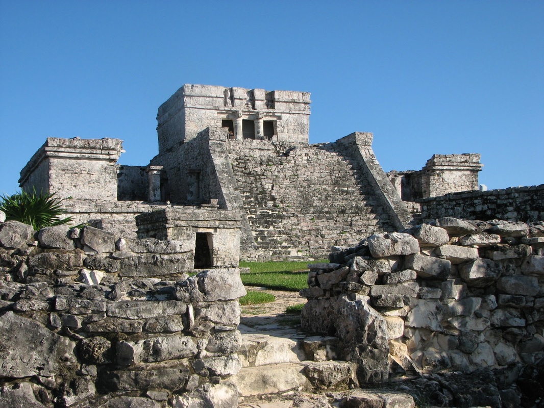
Tulum Mexico
Of the three major structures of interest to be found at the Tulum site, I have already documented El Castillo and the Temple of the Descending God, so it is time I completed the trilogy by introducing you to the Temple of the Frescoes. The Temple of the Frescoes was perhaps the most spectacular of the structures at Tulum thanks to its internal and external decoration. The building was an observatory for tracking the movements of the Sun and included two galleries, a large gallery on the ground floor and a smaller second storey gallery.Niched figurines of the Maya “diving god” or Venus deity decorate the façade of the temple.The frescoes that once decorated the inner walls are no longer in place, having been removed to a museum. The building itself is beautiful in its simplicity; with a little imagination it is easy to see how intriguing it must have appeared to the early European visitors.
Tulum is regarded as the home to the Descending God; the Descending God was so named by the archaeological community because he is always shown with his feet in the air as if he is descending from the sky.
Tulum is regarded as the home to the Descending God; the Descending God was so named by the archaeological community because he is always shown with his feet in the air as if he is descending from the sky.

|

|


|
|
|

|

|

|
|

|


|
|


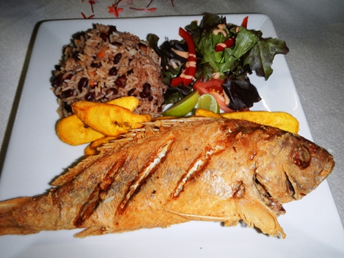
The food of the Yucatán peninsula is distinct from the rest of the country. It is based primarily on Mayan food with influences from the Caribbean, central Mexico, European (especially French) and Middle Eastern cultures. As in other areas of Mexico, corn is the basic staple, as both a liquid and a solid food. One common way of consuming corn, especially by the poor, is a thin drink or gruel of white corn called by such names as pozol or Keyem.
One of the main spices in the region is the annatto seed, called achiote in Spanish. It gives food a reddish color and a slightly peppery smell with a hint of nutmeg.Recados are seasoning pastes, based on achiote - Recado rojo - or a Mixture of habanero and charcoal called Chirmole both used on chicken and pork. Recado rojo is used for the area’s best-known dish, cochinita pibil. Pibil refers to the cooking method (from the mayan word p'ib, meaning "buried") in which foods are wrapped, generally in banana leaves, and cooked in a pit oven. Various meats are cooked this way. Habaneros are another distinctive ingredient, but they are generally served as (or part of) condiments on the side rather than integrated into the dishes.
One prominent feature of Yucatán cooking is tropical fruits such as tamarind, plums, mamey, avocados and bitter oranges, the last often used in the region's distinctive salsas. Honey was used long before the arrival of the Spanish to sweeten foods and to make a ritual alcoholic drink called balché. Today a honey liquor called xtabentun is still made and consumed in the region. The coastal areas feature several seafood dishes, based on fish like the Mero, a variety of grunt and esmedregal which is fried and served with a spicy salsa based on the x'catic pepper and achiote paste. Other dishes include conch fillet (usually served raw, just marinated in lime juice), cocount flavored shrimp and lagoon snails.
Traditionally, some dishes are served as entrées, such as the brazo de reina (a type of tamale made from chaya) and papadzules (egg tacos seasoned in a pumpkin seed gravy).
Street food in the area usually consists of Cochinita Pibil Tacos, Lebanese-based Kibbeh, Shawarma Tacos, snacks made of hardened corn dough called piedras and fruit-flavored ices.
Mexico City
A Chinese-Mexican cafe on Rep de Argentina Street in the historic center of Mexico City.
The main feature of Mexico City cooking is that it has been influenced by those of the other regions of Mexico as well as a number of foreign influences.This is because Mexico City has been a center for migration of people from all over Mexico since pre-Hispanic times. Many of the ingredients of this area’s cooking are not grown here, such as tropical fruits.
Street cuisine is very popular, with taco stands, torta (sandwich) shops, and lunch counters on every street. Popular foods in the city include barbacoa (a specialty of the central highlands), birria (from western Mexico), cabrito (from the north),carnitas (originally from Michoacán), moles (from Puebla and central Mexico), tacos with many different fillings and large sub-like sandwiches called tortas. There are eateries that specialize in pre-Hispanic food including dishes with insects. This is also the area where most of Mexico’s haute cuisine can be found.The main meal of the day in Mexico is the “comida” meaning meal in Spanish. This refers to dinner or supper. It begins with soup, often chicken broth with pasta or a “dry soup”, which is pasta or rice flavored with onions, garlic and/or vegetables. The main course is a meat served in a cooked sauce with salsa on the side, accompanied with beans and tortillas and often with a fruit drink. In the evening, it is common to eat leftovers from the comida or sweet bread accompanied by coffee or chocolate. Breakfast is generally heartier than in other countries and can consist of leftovers, meat in broth (such as pancita), tacos, enchiladas or meat with eggs. This is usually served with beans, white bread and/or tortillas and coffee and/or juice.


|

|

|

|

|

|

|
|


|

|

|

|


|

|


|

|


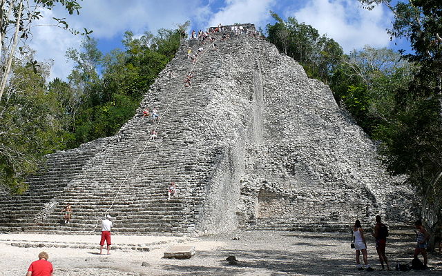
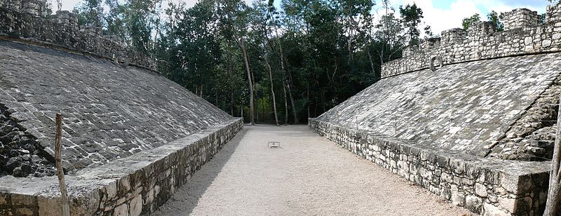
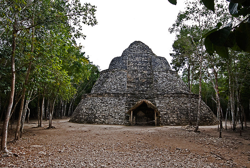
Coba Mexico
|
Coba has Oval temple and also ballcourtCoba[pronunciation?](Cobá in the Spanish language) is a large ruined city of the Pre-Columbian Maya civilization, located in the state of Quintana Roo, Mexico. It is located about 90 km east of the Maya site ofChichen Itza, about 40 km west of theCaribbean Sea, and 44 km northwest of the site of Tulum, with which it is connected by a modern road. The 2010 Mexican federal census reported a population of 1,278 inhabitants.Coba is located around two lagoons. A series of elevated stone and plaster roads radiate from the central site to various smaller sites near and far. These are known by the Maya termsacbe (plural sacbeob). Some of these causeways go east, and the longest runs over 100 kilometres (62 mi) westwards to the site ofYaxuna. The site contains several largetemple pyramids, the tallest, in what is known as the Nohoch Mulgroup of structures, being some 42 metres (138 ft) in height. Ixmoja is the tallest pyramid on the Yucatán peninsula. Coba is estimated to have had some 50,000 inhabitants (and possibly significantly more) at its peak of civilization, and the built up area extends over some 80 km². The site was occupied by a sizable agricultural population by the 1st century. The bulk of Coba's major construction seems to have been made in the middle and late Classic period, about 500 to 900, with most of the dated hieroglyphic inscriptions from the 7th century. However Coba remained an important site in the Post-Classic era and new temples were built and old ones kept in repair until at least the 14th century, possibly as late as the arrival of the Spanish.
Economy[edit]Coba traded extensively with other Mayan communities, particularly the ones further south along the Caribbean coast in what is now Belize and Honduras. It utilized the ports of Xcaret, Xel-Há, Tankah, Muyil, and Tulum. History[edit]Archaeological evidence indicates that Cobá was first settled between 100 BC and 100 AD. At that time, there was a town with buildings of wood and palm fronts and flat platforms. The only archeological evidence of the time are fragments of pottery. After 100 AD, the area around Coba evidenced strong population growth, and with it an increase in its social and political status among Maya city states which would ultimately make Coba one of the biggest and most powerful city states in the northern Yucatán area. Between 200 and 600 AD, Coba must have dominated a vast area, including the north of the state of Quintana Roo and areas in the east of the state of Yucatán. This power resided in its control of large swaths of farmland, control over trading routes, and—critically for a Mayan city—control over ample water resources. Among the trading routes, Coba probably controlled ports like Xel Há. Coba must have maintained close contacts with the large city states of Guatemala and the south of Campeche like Tikal, Dzibanche or Calakmul. To maintain its influence, Coba must have established military alliances and arranged marriages among their elites. It is quite noteworthy that Coba shows traces of Teotihuacan architecture, like a platform in the Paintings group that was explored in 1999, which would attest of the existence of contacts with the central Mexican cultures and its powerful city of the early Classic epoch. Stelae uncovered at Coba are believed to depict that Coba had many female rulers. After 600 AD, the emergence of powerful city states of the Puuc culture and the emergence of Chichén Itzá altered the political spectrum in the Yucatán peninsula and began eroding the dominance of Coba. Beginning around 900 or 1000 AD, Coba must have begun a lengthy power struggle with Chichén Itzá, with the latter dominating at the end as it gained control of key cities such as Yaxuná. After 1000 AD, Coba lost much of its political weight among city states, although it maintained some symbolic and religious importance. This allowed it to maintain or recover some status, which is evidenced by the new buildings dating to the time 1200-1500 AD, now built in the typical Eastern coastal style. However, power centers and trading routes had moved to the coast, forcing cities like Coba into a secondary status, although somewhat more successful than its more ephemeral enemy Chichén Itzá. Coba was abandoned at the time the Spanish conquered the peninsula around 1550. Modern explorations[edit]Knowledge of this expansive site was never completely lost, but it was not examined by scholars until the 1920s. John Lloyd Stephens mentioned hearing reports of the site in 1841, but it was so distant from any known modern road or village that he decided the difficulty in trying to get there was too daunting. For much of the rest of the 19th century the area could not be visited by outsiders due to the Caste War of Yucatán. Teoberto Maler paid Coba a short visit in 1893 and took at least one photograph, but unfortunately did not publish at the time and the site remained unknown to the archeological community. Amateur explorer Dr. Thomas Gann was brought to the site by some local Maya hunters in February 1926. Gann published the first first-hand description of the ruins later the same year. Gann gave a short description to the archeologists of theCarnegie Institution project at Chichen Itza, which sent out an expedition under J. Eric S. Thompson. Thompson's initial report of a surprisingly large site with many inscriptions prompted Sylvanus Morley to mount a more thorough examination of the site. 
|


|

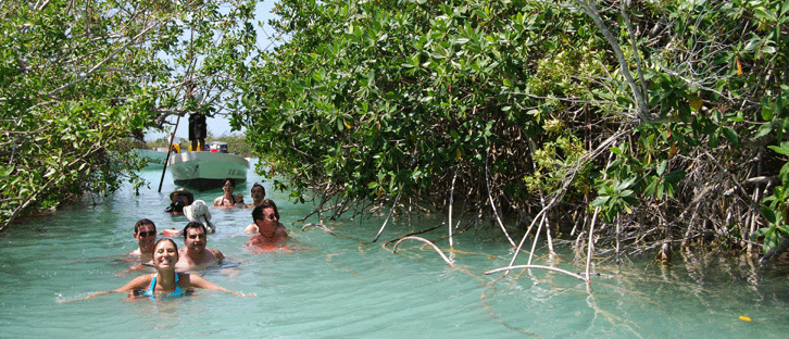
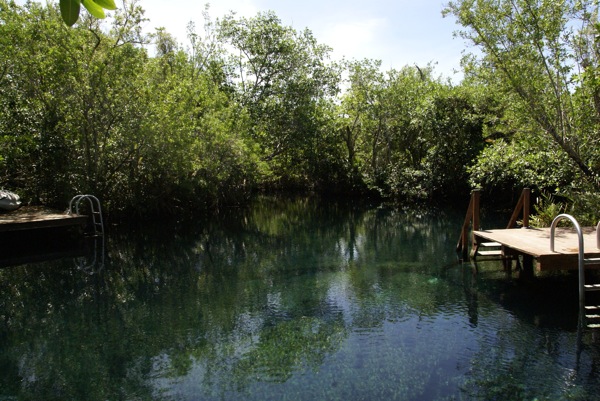
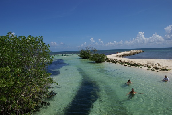
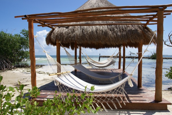
Tres Rios:
Tres Rios we have staid for one day to enjoy the nature.
Tres Rios is a ecological park in an area of low subtropical jungle and mangrove on the Riviera Maya, between Cancun and Playa del Carmen, where you are invited to participate actively to enjoy contact with unspoiled nature. More than 100 species of animals make their home in an exemplary sample of subtropical flora. Enjoy a day of snorkeling, horseback riding, scuba diving and everything nature has to offer. We invite you to explore its unparalleled natural beauty. Tres Ríos is where three rivers meet the sea. It is where culture, nature, and experience merge in an award-winning eco-sensitive facility that provides a retreat unlike any other.

|
|
|


- Getting to Croco Cun Zoo from Cancún by bus or minivan (costs around 25 pesos per person), the driver will drop you out in front of the zoo on the federal highway. Please be carefull when you crossing.
- To get to Cancún´s bus station from the Cancún hotel zone, take the bus (Turicun or Autocar) with RUTA 1 on the window. (it must include Downtown, Av. Tulúm destinations) and ask the driver to drop you out on Tulum Av. near the bus station. It costs around 12 pesos per person.
|
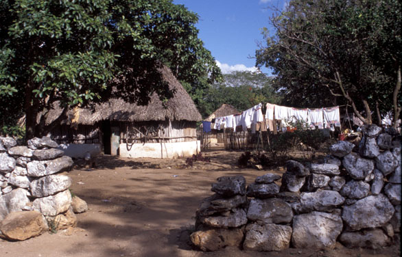
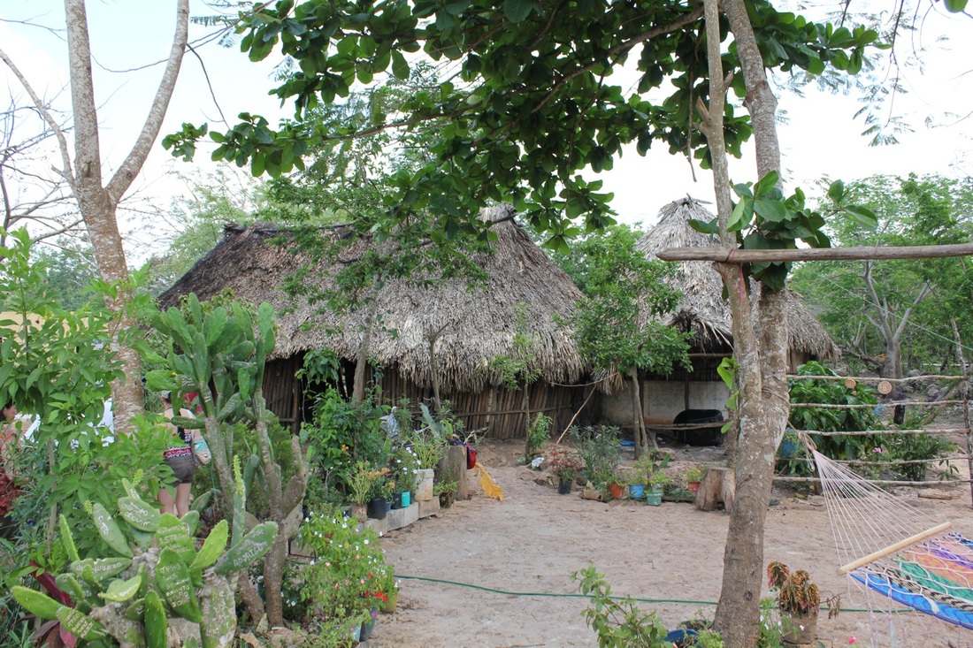
On the way to town of Vallidolid and also to Tulum we have passed trough so many small Mayan villages.
The also have a small market places for sealing silver turquoises and also rugs and ceramics.Mot of the locals sleep in a hammocks and also have small gardens. |
|
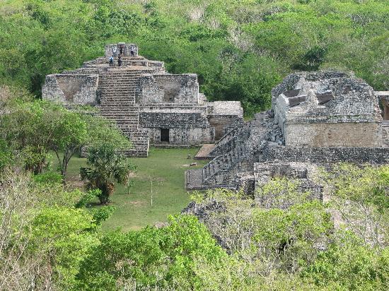
Ek Balam Oasis

Ek' Balam[pronunciation?] is a Yucatec-Mayaarchaeological site within the municipality of Temozón,Mexico, in the Mid-east of the Northern lowlands, and 51 kilometres (32 mi) northeast of Chichen Itza. From the Preclassic until the Postclassic period, it was the seat of a Mayan kingdom.Ek’ Balam was occupied from the Middle Preclassic through the Postclassic, although it ceased to thrive as a major city past the Late Classic. Beginning in the Late Preclassic, the population grew and the city expanded throughout the following periods. It eventually became the capital of the polity that constituted the region around the beginning of the Common Era.
At its height from 770 to 840 CE, Ek' Balam provides a rich resource of information for understanding northern Classic cities, due to the poor preservation of many other notable northern Maya sites (e.g. Coba, Izamal, and Edzna).It was during this height that the Late Yumcab ceramic complex (750-1050/1100 CE) dominated the architecture and pottery of Ek’ Balam. The population decreased dramatically, down to 10% of its highest, during the Postclassic period as Ek’ Balam was slowly becoming vacant. There are several theories to why it was eventually abandoned and to the degree of haste at which it was abandoned (see:Defensive Walls).
At its height from 770 to 840 CE, Ek' Balam provides a rich resource of information for understanding northern Classic cities, due to the poor preservation of many other notable northern Maya sites (e.g. Coba, Izamal, and Edzna).It was during this height that the Late Yumcab ceramic complex (750-1050/1100 CE) dominated the architecture and pottery of Ek’ Balam. The population decreased dramatically, down to 10% of its highest, during the Postclassic period as Ek’ Balam was slowly becoming vacant. There are several theories to why it was eventually abandoned and to the degree of haste at which it was abandoned (see:Defensive Walls).
|
|
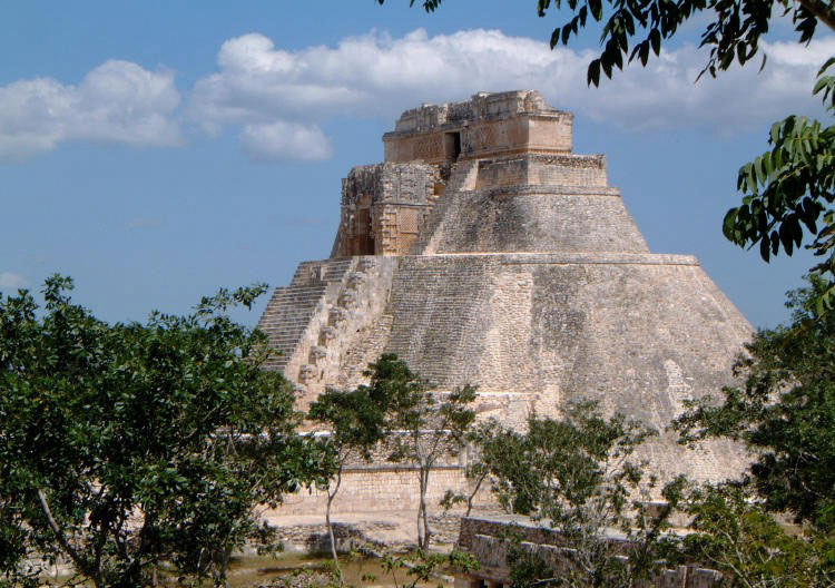
Uxmal
|

|

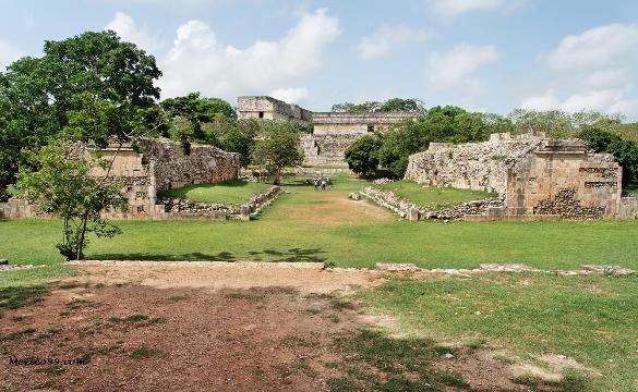
Archaeological sites of Maya culture, along with Chichen Itza in Mexico; Caracol and Xunantunich in Belize, and Tikal in Guatemala. It is located in the Puuc regionand is considered one of the Maya cities most representative of the region's dominant architectural style. It has been designated a UNESCO World Heritage Site in recognition of its significance.
It is located 62 km south of Mérida, capital of Yucatán state in Mexico. Its buildings are noted for their size and decoration. Ancient roads called sacbes connect the buildings, and also were built to other cities in the area such as Chichén Itzá, Caracol and Xunantunich in modern-day Belize, and Tikal in modern-day Guatemala.
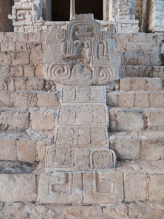
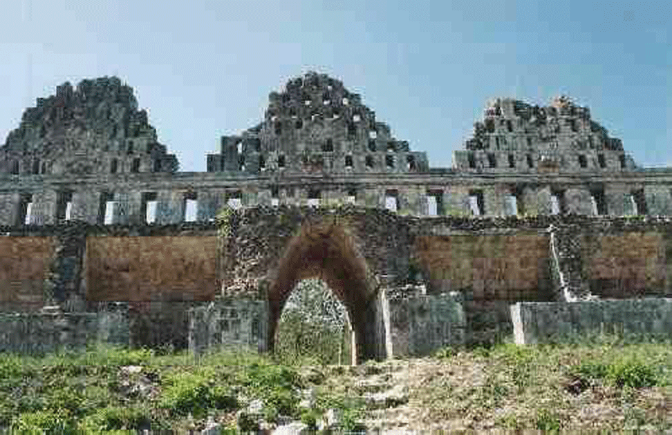
Its buildings are typical of the Riley Kand Puuc style, with smooth low walls that open on ornate friezes based on representations of typical Maya huts. These are represented by columns (representing the reeds used for the walls of the huts) and trapezoidal shapes (representing the thatched roofs). Entwined snakes and, in many cases two-headed snakes are used for masks of the rain god, Chaac; its big noses represent the rays of the storms. Feathered serpents with open fangs are shown leaving from the same human beings. Also seen in some cities are the influences of the Nahua, who followed the cult of Quetzalcoatl and Tlaloc. These were integrated with the original elements of the Puuc tradition.
The buildings take advantage of the terrain to gain height and acquire important volumes, including the Pyramid of the Magician, with five levels, and the Governor's Palace, which covers an area of more than 1,200 m2 (12,917 sq ft).
It is located 62 km south of Mérida, capital of Yucatán state in Mexico. Its buildings are noted for their size and decoration. Ancient roads called sacbes connect the buildings, and also were built to other cities in the area such as Chichén Itzá, Caracol and Xunantunich in modern-day Belize, and Tikal in modern-day Guatemala.
Its buildings are typical of the Riley Kand Puuc style, with smooth low walls that open on ornate friezes based on representations of typical Maya huts. These are represented by columns (representing the reeds used for the walls of the huts) and trapezoidal shapes (representing the thatched roofs). Entwined snakes and, in many cases two-headed snakes are used for masks of the rain god, Chaac; its big noses represent the rays of the storms. Feathered serpents with open fangs are shown leaving from the same human beings. Also seen in some cities are the influences of the Nahua, who followed the cult of Quetzalcoatl and Tlaloc. These were integrated with the original elements of the Puuc tradition.
The buildings take advantage of the terrain to gain height and acquire important volumes, including the Pyramid of the Magician, with five levels, and the Governor's Palace, which covers an area of more than 1,200 m2 (12,917 sq ft).


|

|
